 |
Ochopee – Due to multiple fires within the same unit of Big Cypress National Preserve, the Avian Complex will now include and report on the Buzzard, Vulture and Caracara fires. Information regarding these fires, including maps, and fire area closures can be found on InciWeb.
Rain fell across the Buzzard Wildfire on Monday, slowing fire progression. The fire continues to move west towards the Oasis Trail, and crews have focused on prepping any structures potentially at risk by removing brush, and any other fuels from around buildings. The revised Closure Order does impact the Florida Trail. During this closure, all recreational use including Off-Road Vehicle (ORV), hiking, hunting, camping and commercial activities will be prohibited in the designated areas. This is to promote visitor safety during wildfire activity in this area. Travel through the preserve on US-41 has not been impacted by the fire. The Buzzard Wildfire was reported on April 10, 2018. The fire has burned approximately 7,193 acres, and remains at 20% containment. The cause of this fire has been identified as a lightning strike. The Vulture Wildfire, first reported on April 10, 2018, has been 100% contained. The cause of this fire has been identified as a lightning strike. This will be the last update for the Vulture Fire The Caracara Fire which was first reported April 17, 2018, located in the sanctuary portion of the preserve near the canal, has burned approximately 1 acre, and is 100% contained. The cause is under investigation. This will be the last update for the Caracara Fire. The priorities for these fires will remain visitor and firefighter safety. Ground and aviation personnel will continue to identify and protect values at risk. The best contact for the Big Cypress National Preserve wildfires is the Public Information Officer, 720-837-9591 |
 Click map for bigger image |
|
Category Archives: Park & Land Management
Avian Fire Update
Big Cypress Trail Closings
2018-Apr-10
 |
Ochopee –The Spoonbill Wildfire, as of April 10th at 0800, has burned roughly 1,843 acres and is located approximately 2 miles north of I-75 at mile marker 69 and north and west of the Bundschu Grade in the area of Little Marsh. The Bundschue Grade and areas remain closed due to the fire crossing that trail. During this closure, all recreational use including Off-Road Vehicle (ORV), hiking, hunting, camping and commercial activities will be prohibited in the designated areas. This is to promote visitor safety during wildfire activity in this area.
The Spoonbill Wildfire is within .5 miles of the recent Leprechaun Fire, and the cause is under investigation. There is 80% containment at this time. The Cormorant Fire, in the vicinity of the recent Anhinga Wildfire, showed little to no growth and will continued to be monitored. This fire was identified as a lightning strike. |
Big Cypress Trail Reopennings
2018-Mar-28
|
Per National Park Service: OCHOPEE – Big Cypress National Preserve is pleased to reopen the closures from the Anhinga Wildfire. The following areas are open immediately: Pink Jeep, Gator Head and Bear Island Campgrounds. The opening also includes the following roads and trails: These areas are now open to safe recreational use including hiking, hunting, ORV, and camping. |
Big Cypress Trail Reopennings
2018-Mar-22
|
Per National Park Service: Big Cypress National Preserve is pleased to reopen the closure from the Kirby Prescribed Fire. Prescribed fire activities for this area have been cancelled. The following area is therefore immediately open: Monroe South Trail located south just off US 41/Tamiami Trail and Loop Rd. at Monroe Station. This area is now open for safe recreational use including hiking, ORV’s, and hunting. The Leprechaun Wildfire is currently 75 percent contained. |
Update: Closures, Bear Island Area
2018–Mar-10
|
Per National Park Service:
|
For full NPS advisory please see:
2018-03-10, Big Cypress National Preserve Issues Emergency Closure of Bear Island Campground for Wildland Fire
Closure Bear Island Campground
2018–Mar-05
|
Per National Park Service:
|
For full NPS advisory please see:
2018-03-04, Big Cypress National Preserve Issues Emergency Closure of Bear Island Campground for Wildland Fire
InciWeb For Park Incident Info
Before heading out to wheel, check out InciWeb .

The information is drawn from several US agencies covering multiple states. The site provides summary as well as detailed information & maps and is constantly updated. A must check before loading up and hitting the trails at National Parks and State managed lands.
NPS: Cowbell Wild Fire Update
2017-Apr-12
|
Updated Restrictions & Closures as of April 12th: The following closures remain in place in Big Cypress National Preserve:
The following adjacent areas will remain open:
|
Visit the Big Cypress Preserve Information Page for more including trail access and permitting process.
NPS – Big Cypress Advisory
Cowbell & Parliament Fires
|
Updated Closures as of March 24: Burns Lake and Monument Campgrounds Closed Due to Wildfire Activity
Per NPS Big Cypress Preserve.
|
Visit the Big Cypress Preserve Information Page for more including trail access and permitting process.
Keeping Tabs on Local Trails
With available Off Road trails disappearing every year, we at Jeep Off-Road Adventures feel it is important to make timely and valuable information on permitted trail riding available to the Jeeping community.
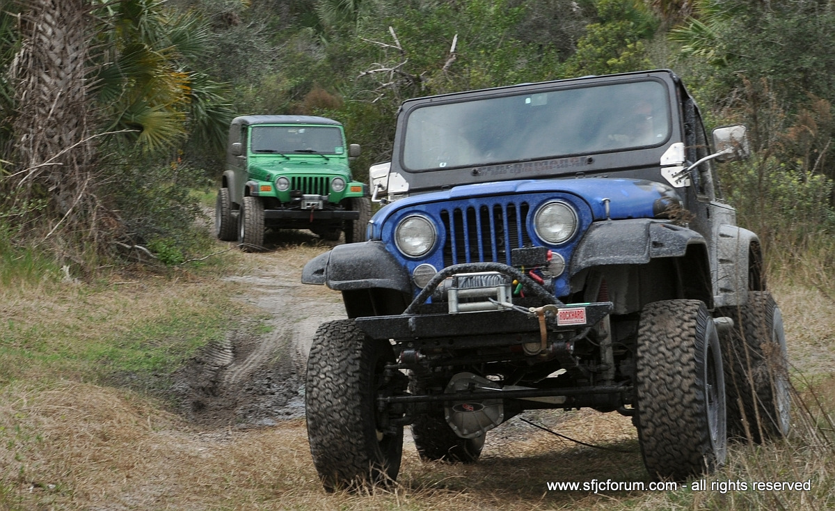
Jeeps from The South Florida Jeep Club and Caloosa Jeepers enjoying the trails at Bear Island Unit
And while these trails represent a place we can drive our Jeeps, this is also a place where we need to be responsible and show respect for the privileged access. After all these are valuable and cherished environments not to be spoiled.
So, to this end we have setup an index page to keep track of access and land management issues for Big Cypress Preserve and Bear Island Unit. Brief updates will be posted directly to the blog while detailed reports and useful reference material will be added and updated regularly to the index page.
Our hope is the information will make wheeling more enjoyable by making access and compliance to the trails easier to understand.